Transportation
Diesel Roster
Steam Roster
Ferry Roster
Rolling Stock
Wrecks
Railroadiana
Advertisements
Dining Car
Maps
Matchbooks
Miscellany
Models
Passes
Scripophily
Tickets
Timetables
Media
Structures
People
Route of the Eagles Forum
Sign In
Maps
Home
›
Railroadiana
› Maps
95 images
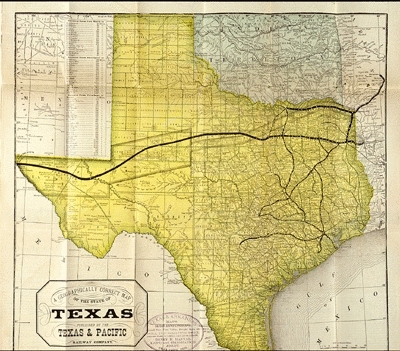
1883 Map
1929 Map
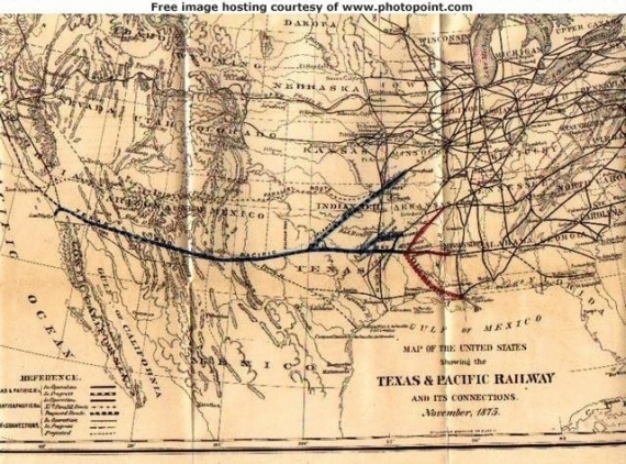
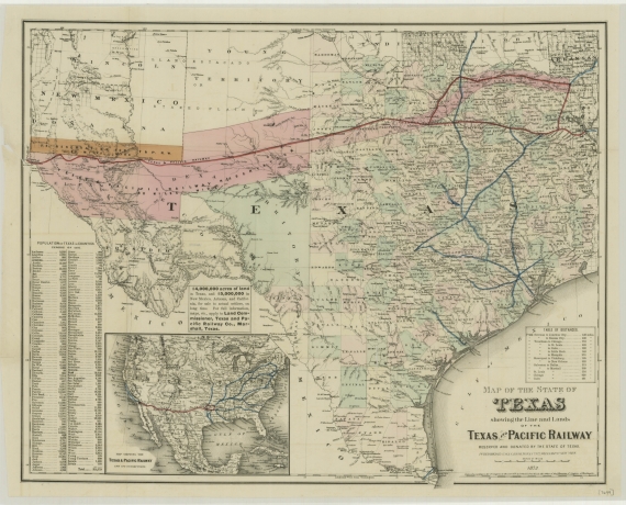
1875 Map
Map
Map
c1885
c1880s
c1880s
Line and Lands of the T&P
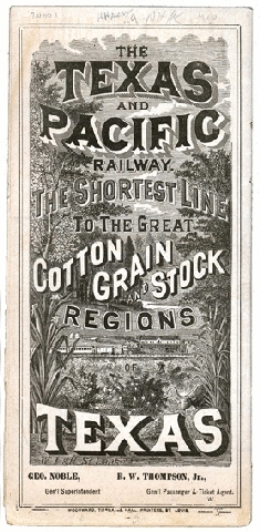
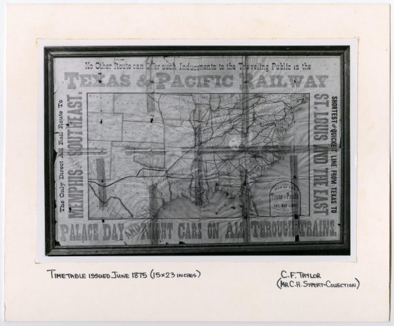
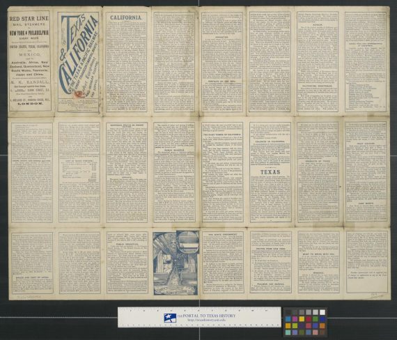
T&P Map and Advertisement
South boundary line of the Texas and Pacific Railway 80 mile reserve.
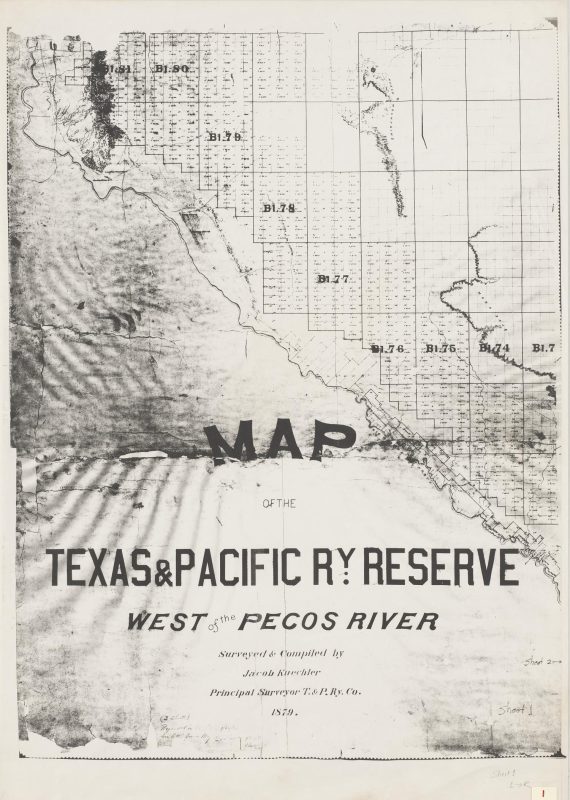
Map of the Texas and Pacific RY Reserve West of the Pecos River 1.
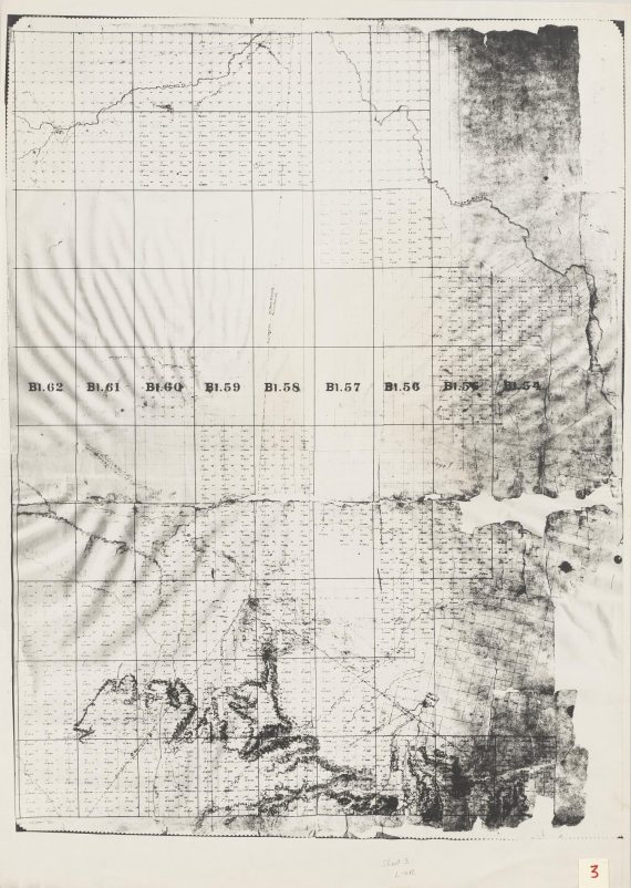
Map of the Texas and Pacific RY Reserve West of the Pecos River 2.
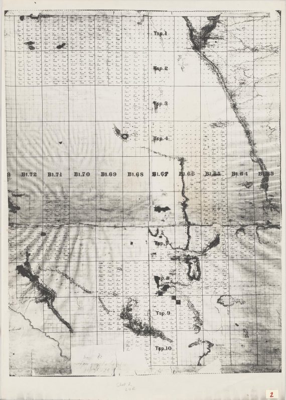
Map of the Texas and Pacific RY Reserve West of the Pecos River 3.
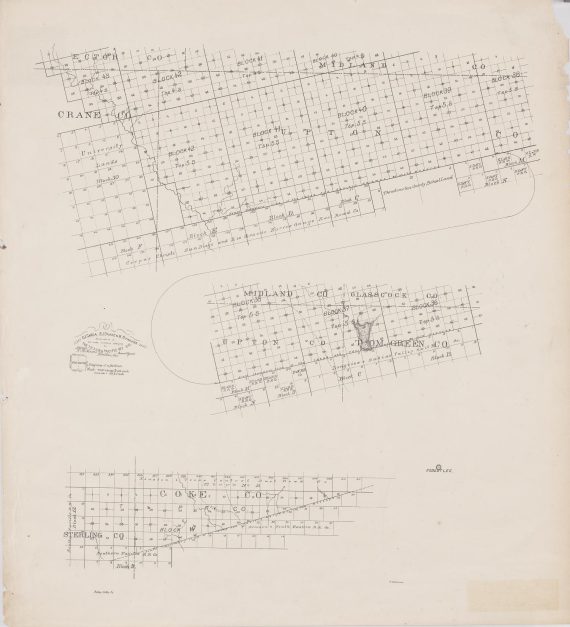
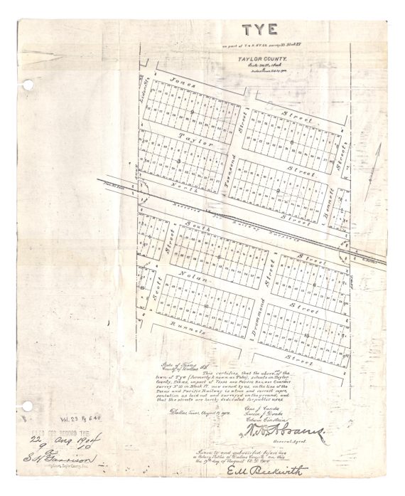
Tye: on part of Texas and Pacific Railway Company survey 33, Block 27
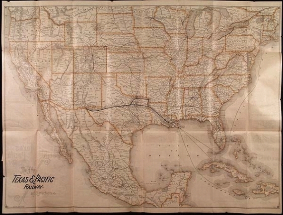
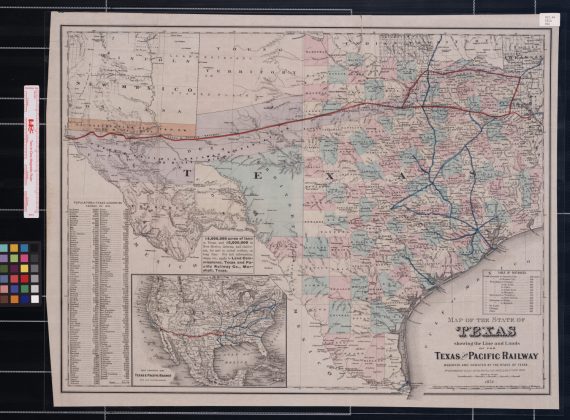
Map of the State of Texas showing the line and lands of the Texas and Pacific Railway.
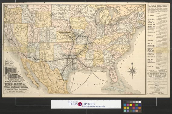
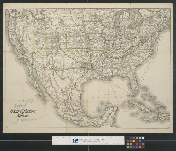
Map of the south west railway system: Missouri Pacific Ry. Central Branch U.P.R.R., Missouri Kansas & Texas Ry., Texas and Pacific Ry., St. Louis, Iron Mount & Southern Ry., International and Great Northern Ry. and their connections.
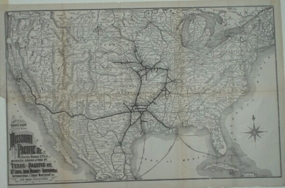
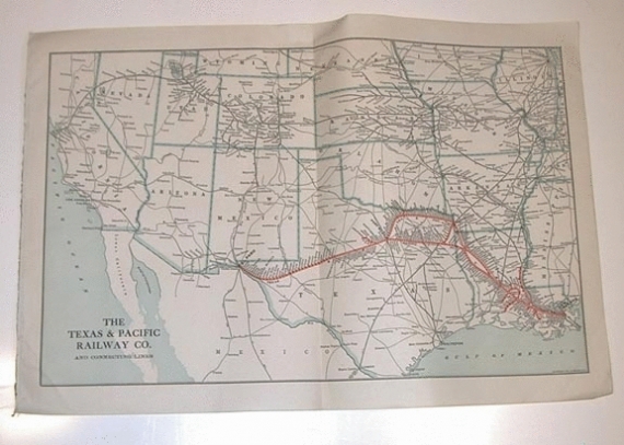
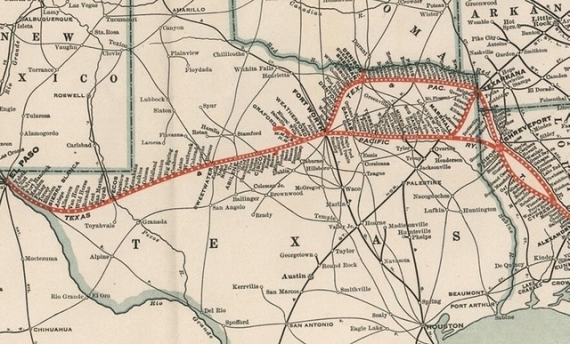
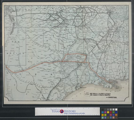
Map of the Texas & Pacific Railway and connections.
Map of the Texas & Pacific Railway and connections.
Map of the Texas & Pacific Railway and connections.
Map of the Texas & Pacific Railway and connections.
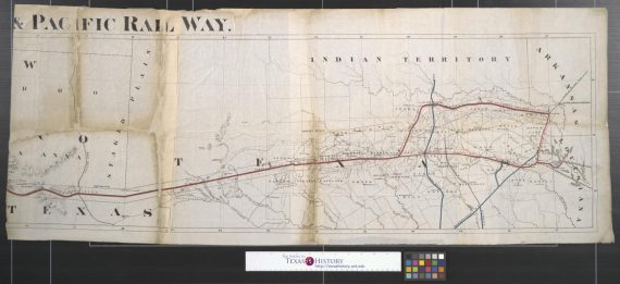
Map of the Texas & Pacific Rail Way Sheet 2.
Map of the Texas & Pacific Rail Way Sheet 2.
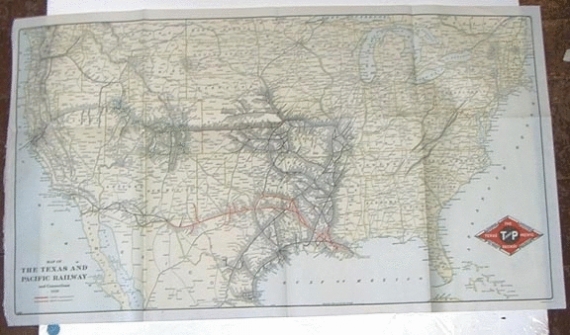
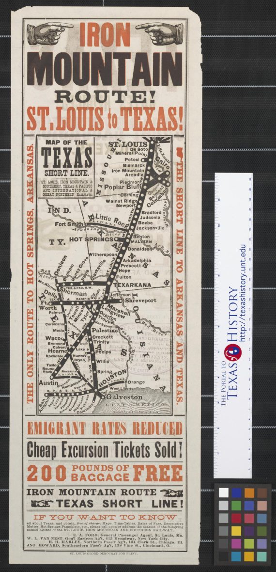
Map of the Texas short line: St. Louis, Iron Mountain & Southern, Texas & Pacific and International & Great Northern Railways.
« Previous
Next »
Showing
1
to
24
of
95
results
1
2
3
4
×